 |
|
 |
|
|
|
|
Concerning Hobbits | Calendars & Chronologies | Shire Library | Shire Geography>Shire Guidebook>Buckland and Natural Features | Mathom House (Misc) | Home
Buckland is a small and thickly inhabited strip of land on the east side of the Brandywine River. Its eastern border is the Old Forest. Settled in TA 2340, it did not formally become part of the Shire until FO 32.
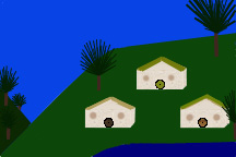
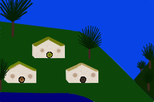
Bucklebury - Bucklebury is the home of the Brandybucks and the chief village of Buckland. Bucklebury was settled by the Oldbucks of the Marish. Brandy Hall, built into an entire side of a low hill (Buck Hill), has three large front-doors, many side-doors, and a hundred windows. It has one of the largest libraries in the Shire. The village of Bucklebury is clustered around the banks and slopes behind Brandy Hall.
Crickhollow - This small community is in the northern part of Buckland near the Old Forest. It began life as a hideaway for Brandy Hall.
Haysend/Hays-End - This picturesque community lies at the edge of the Old Forest at the point where the Withywindle River meets the Brandywine River. It is at the southern end of the High Hay, the 20-mile long hedge that separates Buckland from the Old Forest.
Newbury - Newbury is located north of Crickhollow in the northern part of Buckland.
Standelf - This southern community is located between Brandy Hall and Haysend.
Undertowers - Undertowers is a community on the east edge of the Tower Hills. It is the home of Fairbairns of the Tower. The original Red Book of Westmarch is kept here.
Bindbale Wood - Bindbale Wood is a forest in the Northfarthing.
Brandywine River - This river divides Buckland from the Shire and forms the eastern boundary of the Shire north of the Buckland bulge.
Bywater Pool - This body of water is just north of Bywater in the Westfarthing.
Hobbiton Hill/The Hill - Hobbiton Hill separates Hobbiton and Overhill in the Westfarthing.
Overbourn Marshes - These marshes are in the south-eastern corner of the Southfarthing.
River Shirebourne - The Shirebourne runs into the Brandywine River in the Southfarthing.
Rushock Bog - Rushock Bog is a marshy area along The Water in the Westfarthing.
Thistle Brook - The Thistle Brook is a river in the Southfarthing.
The Water - This river runs through the West and East Farthings and flows into the Brandywine River.
Woody End - Woody End is a forest in the southern part of the Eastfarthing.
Brandywine Bridge to the Far Downs - 40 leagues (120 miles).
Brandywine Bridge to Frogmorton - 22 miles.
Brandywine Bridge to Haysend - Almost 20 miles (The High Hay, the hedge which forms the eastern boundary of Buckland, is 20 miles long, but this distance includes a bend so the actual length of Buckland would be a little less).
Bywater to Hobbiton - These villages are "over a mile" apart. Bilbo Baggins has been known to run between the two in ten minutes. Some maps suggest that Bywater and Hobbiton are four miles apart.
Bywater to Frogmorton - 18 miles.
Bywater to the Three-Farthing Stone - 4 miles.
Bywater to Waymeet - 15 miles.
Hobbiton to Tuckborough - 14 miles.
Michel Delving to Waymeet - about 30 miles.
Southern Marshes to the Western Moors - 50 leagues (150 miles).
Sources:
The Atlas of Middle-Earth, Karen Wynn Fonstad, New York: Houghton Mifflin Company, 1991.
The Complete Guide to Middle-Earth: From the Hobbit Through the Lord of the Rings and Beyond (Tolkien's World From A to Z), Robert Foster, New York: Ballantine Books, 2001, 1971.
Journeys of Frodo: An Atlas of JRR Tolkien's The Lord of the Rings, Barbara Strachey, London: HarperCollins Publishers, 1998, 1981.
And,
The Lord of the Rings by JRR Tolkien.
Visit "Shire Guidebook: The Shire"
Visit "Shire Geography"
Visit our smial (home)
Updated January 3, 2012